


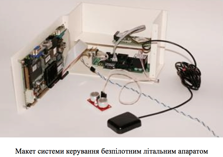
Complex application of unmanned aerial vehicles for the tasks of industrial and ecological reconnaissance
Modern complex control algorithms for group of unmanned aerial vehicles (UAVs) are developed. Developed and implemented a control system for the integrated use of UAVs group through the use of machine vision systems. Worked out algorithms and guidance system means that are installed on board of each UAV. Proposed system calculates the spatial position of the leading UAV, that are converted into command signals for characterization end estimation of the changing in the spatial position of the leading UAV. The developed software for UAV guidance systems in the group application that realizes the proposed algorithms as representation of all the identified UAVs contours in the image resulting in a contours filtering stage that lets apply a combination of methods of identification of images. To solve the problems of monitoring and navigation designed and used a number of the mask filters for modified using the contour coding binary images. Designed and simulated adaptive binarization algorithm of multispectral images for the purpose of a thematic classification of the contour lines of objects. The mechanism for the elimination of possible errors in the identification stage of filtration of navigation map contours is designed. Autopilot operation was simulated. The simulation includes algorithms for UAV control systems and stabilization to ensure flight of UAVs formation.
| Attachment | Size |
|---|---|
| 434.89 KB |