Based on satellite data scenario modeling of critical changes in the ecological and economic state of temporarily occupied territories as a factor of national security of Ukraine
An information system for monitoring changes in the land cover of the territories based on satellite data was created. The system is integrated into the Information and Analytical Situation Center of the Igor Sikorsky Kyiv Polytechnic Institute.
A complex of methods and models has been developed, based on which the degree of transformation of land cover types is evaluated, critical changes are identified, and their classification by type of transformation is carried out. Methods used to identify transformations:
- comparison of images at different time intervals with manual fixation of changes;
- the method of map algebra and the overlay method, where the classification of images according to the types of land cover is performed first, and then an algebraic comparison of the permanence of the cover is carried out;
- deep learning models for classification of land cover types, identification of target objects, etc.
The system for monitoring critical land cover changes collects and analyzes geospatial data on the selected territory. It works on two types of data sources:
- composites of the Sentinel-2, Landsat-8, etc. satellites. – the system uses trained machine learning models to classify the types of land cover;
- open databases of geospatial data, the indicators of which are used for the analysis and monitoring of land cover changes.
The user selects the target area, the desired land cover types for research, and the degree of change that he, as an expert, considers critical. Monitoring takes place in real time as new data on the territory appear, the periodicity is affected by: cloudiness of the territory, moments of fixation of the territory on the relevant satellites, the size of the territory, etc.
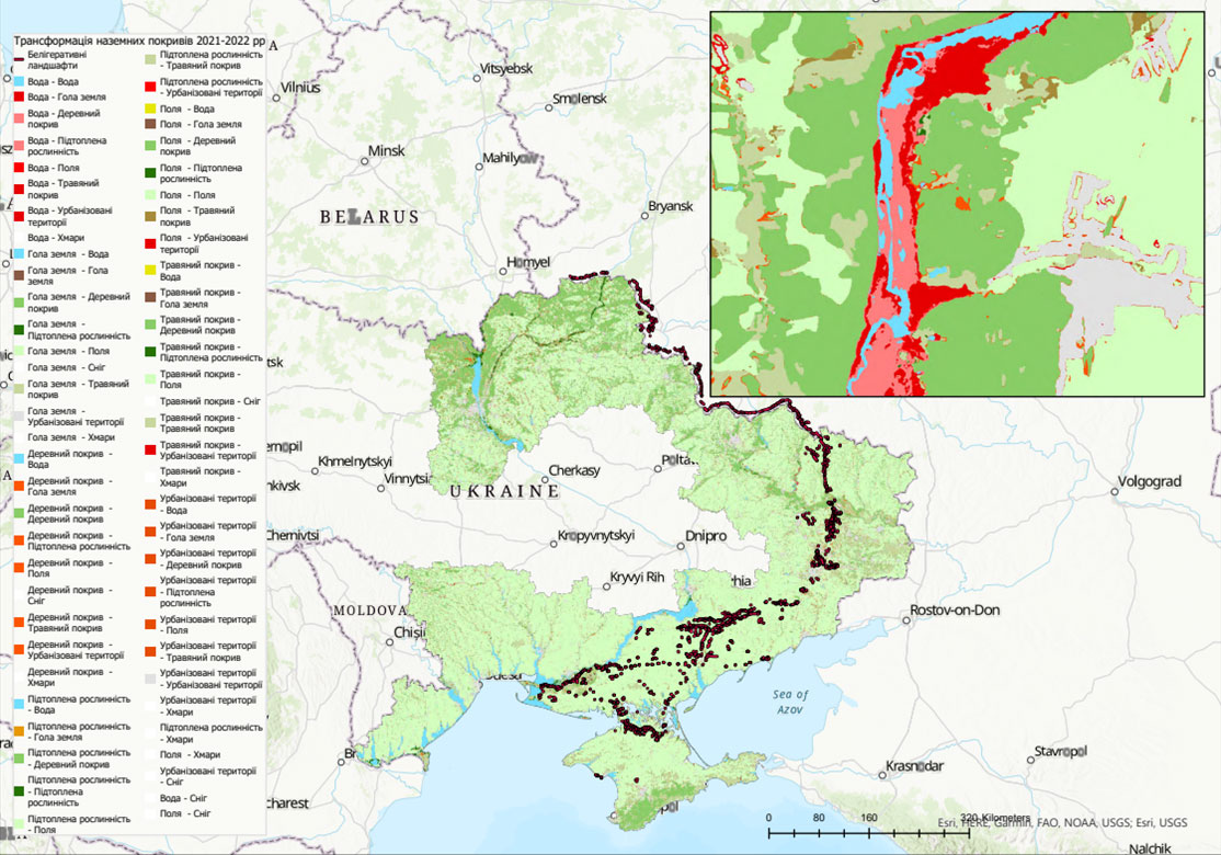
On the basis of collected satellite data and open data from cataloged sources, a retrospective analysis of the transformation of land cover types of the territories of 10 regions of Ukraine, the city of Kyiv and Sevastopol was carried out in order to identify critical changes that affect the ecological and economic state and may pose a threat to the national security of Ukraine. Based on the analysis, geospatial layers of identified areas with a significant degree of transformation and the presence of critical changes were obtained. Critical transformations between each year were separately analyzed pairwise, with a separate focus on critical transformations that were caused by acts of full-scale war.
Geospatial scenario models of critical changes in the ecological and economic state of the studied territories were built, in particular, the following were developed:
- models of changes in the water cover due to the destruction of hydro-technical structures, methods of assessing ecological and economic consequences are presented;
- models and methods for assessing and forecasting the state of the fields of the temporarily occupied territories;
- models for the analysis of belligerent landscapes as new formations on the territory of Ukraine.

| Вложение | Размер |
|---|---|
| 252.45 КБ |


