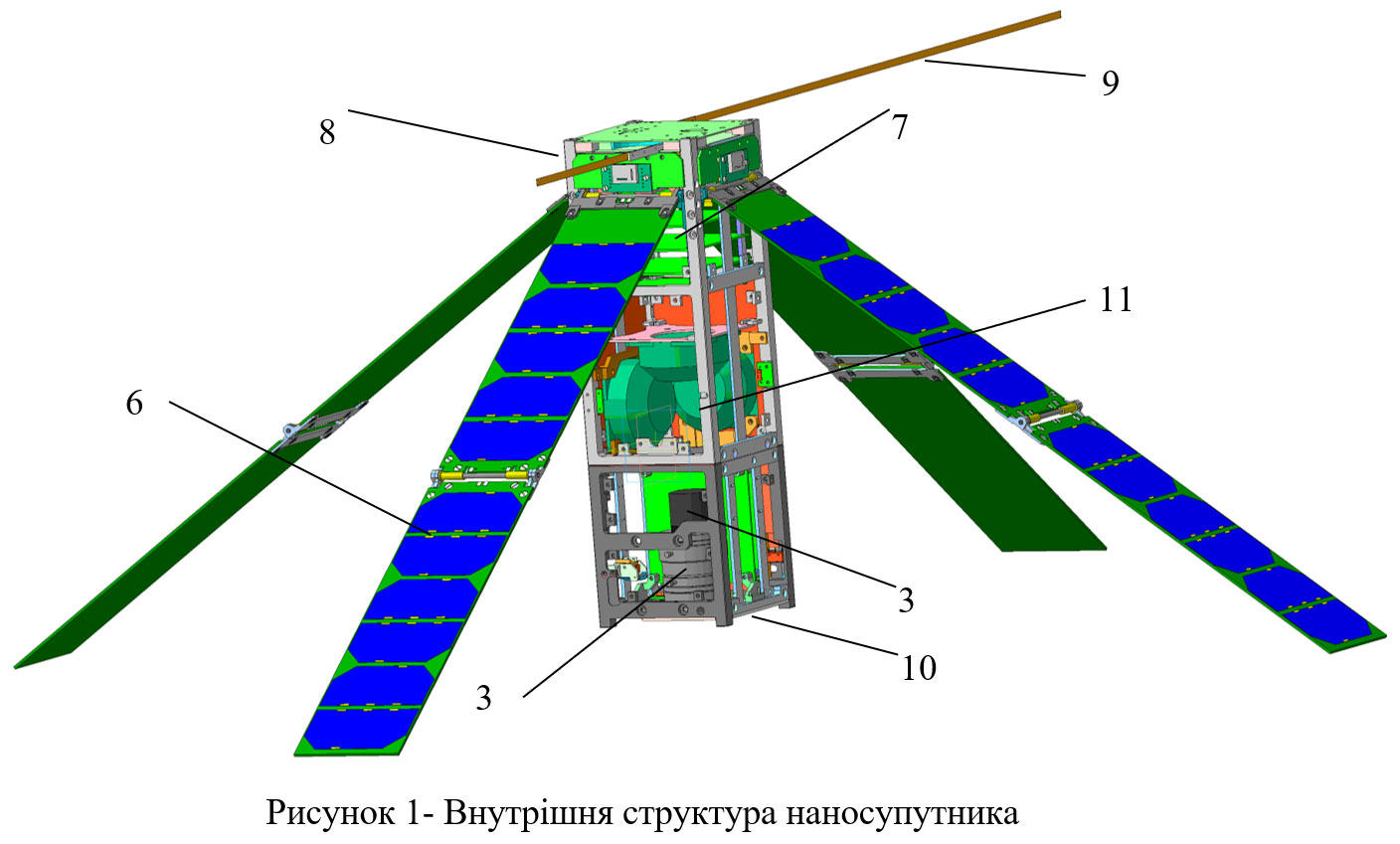
Research and testing of the flight model of the university nanosatellite PolyITAN-3-PUT format Cubesat for remote sensing of the Earth
There are done improved development and modeling, manufacturing and research of subsystems - power supply, navigation and orientation with a flywheel - electromagnetic executing mechanism and sensors for determining the coordinates of the Sun, high-speed radio communication and telemetry, an optoelectronic scanner, control and data processing - a flight model of a nanosatellite (NS) PolyITAN-3 -PUT 3U CubeSat format for remote sensing of the Earth. Including were:
1. Manufactured and tested:
- design of the case and solar panels for power supply (EPP) NS,
- passive thermal control subsystem for space applications,
- a subsystem of an on-board optical-electronic scanner (OES) according to the developed circuitry and design solution of the OES to ensure a given spatial and energy separation with the process of generating initial information on board
- flight model of the board of the navigation and orientation subsystem with an ASN 5206N receiver of signals from international satellite navigation systems GPS / GLONASS (determination of speed - 0.05 m / s, time - 40 ns, altitude - 5 m)
- flight prototype of the PED board on board the nanosatellite (the PES system ensures the operation of the primary energy source (solar batteries) for loading and charging the battery (typical for illuminated parts of the orbit) with maximum power take-off
- flight sample of the telemeter subsystem board at frequencies of 145/435 MHz
2. Created by:
- - a computational mathematical model of a space OES, taking into account the main factors of information formation during observations, which will allow performing the tasks of analysis and synthesis of the system, and justified technical solutions to increase the signal-to-noise ratio in the OES at a given energy sensitivity and motion parameters,
- - mathematical models for integrating the NS flight trajectory using GLONASS / GPS measurements of the ASN-5206N receiver, refining the satellite flight trajectory
- - a numerical model of the thermal state of the main systems and, in general, the NS, taking into account the position of the satellite in orbit, the thermal loads acting on it and the generation of heat by individual elements of the systems;
- a unified data processing subsystem and software required for the functioning of all NS subsystems.
- - software of the diagnostic algorithm for all subsystems and payload - OES, during the NS orbital flight to correct the onboard time scale according to signals from the navigation subsystem or the communication subsystem,
- methods and techniques for minimizing the mass-dimensional parameters of nanosatellite structures,
- methods for optimizing the formation of initial data for the cyclograms of the operation of emergency systems, taking into account the energy constraints for each of the subsystems of the electronic platform and means for maximizing the energy supply of the nanosatellite, which will increase the resource of its functioning in orbit,
- BCS design based on nanocrystalline silicon layers and proven technology for the manufacture and installation of the developed structures
- means of ensuring the thermal mode of operation, the program and methodology for conducting heat-vacuum tests of the nanosatellite
- software for the diagnostic algorithm of all subsystems and payload during an emergency orbital flight and correction of the onboard time scale based on signals from the navigation subsystem
- PM for conducting thermal vacuum tests of all NS subsystems (ground testing).
- stands for simulating external magnetic fields of the Earth for the subsystem of orientation and stabilization of emergency situations and their software.
- stands for autonomous and complex ground tests of the NS flight model with the SMX-20S12M OES and the ASN-5206N GPS / GLONASS receiver (modified for space use) in a thermal vacuum chamber under the influence of space factors.

| Attachment | Size |
|---|---|
| 580.53 KB |


